
PAKISTAN AGRICULTURAL COALITION
CONVERSATION MAP
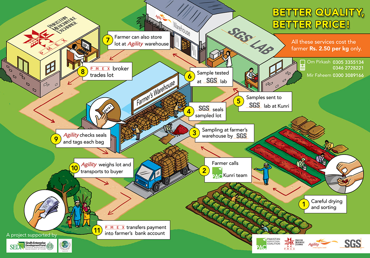
This map was created as part of a project to educate local farmers about the technology used in the agricultural supply chain, showing all the different steps from sorting, sampling and testing to trading, weighing and payment.
LAYOUT AND COMPOSITION
Initial sketches were created to give an idea of what the map would look like. The map read from right to left as the text was going to be in Urdu.

Different versions were sketched out in grayscale with text, with many iterations until a layout that was easy to understand, not too cluttered and had just enough detail for the user to recognise and understand the steps was finalised.
Below are some of the grayscale sketches at various stages:


COLOURS
Once the layout and text were finalised, colours and other details were added to it.
Below are some of the coloured options:


FINAL MAP
This is what the final version that was presented to the farmers turned out to be:

English version:
Thank you!


